top of page
About

Agricultural Operations

​​​​​

Agricultural and rural drone operations can support improved visibility, mapping, monitoring, and operational awareness across large properties and remote environments where ground-based inspection may be time-consuming, difficult, or operationally limited by terrain and distance.

+ Drone-based aerial information capture may support paddock and livestock monitoring, livestock location and mustering support activities, infrastructure visibility, water and storage assessment, solar, pump, trough, and farming infrastructure monitoring, terrain and drainage awareness, repeatable seasonal monitoring, aerial distribution planning, and current property records supporting operational and management activities.

Operations:

Farm and rural infrastructure inspections

Property, paddock & asset mapping

Livestock and feedlot monitoring
+ Livestock location and mustering support
+ Water point, dam, and tank assessment
+ Solar, pump, and trough inspections
+ Terrain, drainage & access visibility
+ Seasonal and repeat property monitoring
Licensed aerial distribution planning & support

+ Spray & seeding maps

Operational Value:

+ Faster visibility across large properties
+ Current and repeatable property records
+ Better livestock & feedlot awareness
+ Easier water, drainage & access monitoring
+ Seasonal comparison over time
+ Property planning and reporting support
+ Reduced time spent on routine property inspections
+ Improved planning, reporting & communication

+ Repeatable biosecurity records

+ Support for aerial application activities

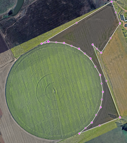
VHL-Loraine-Pivot_1a_031225
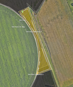
VHL-Loraine-Pivot_1_031225
VHL-Feedlot-Fields-2_031225
VHL-Feedlot-Fields1and2_031225
VHL-Feedlot-Fields-1_031225
VHL-Feedlot-Fields-1a_031225
VHL-Feedlot8
VHL-Feedlot7
VHL-Feedlot6
VHL-Feedlot5
VHL-Feedlot4
VHL-Feedlot2
VHL-Feedlot3
VHL-Feedlot1
Screenshot 2026-04-28 095553
Screenshot 2026-04-28 093648
Screenshot 2026-04-28 093602
Screenshot 2026-04-28 093418
Screenshot 2026-04-28 093341
Screenshot 2026-04-28 093223
Screenshot 2026-04-28 093132
Screenshot 2026-04-28 093114
Screenshot 2026-04-28 093050
Screenshot 2026-04-28 093018
Screenshot 2026-04-28 093040
Screenshot 2026-04-28 092945
Screenshot 2026-04-28 092926
Screenshot 2026-04-28 092828
Screenshot 2026-04-28 092815
Screenshot 2026-04-28 092749
Screenshot 2026-04-28 092721
Screenshot 2026-04-28 092631
Screenshot 2026-04-28 092648
Screenshot 2026-04-28 092517
Screenshot 2026-04-28 092604
Screenshot 2025-12-04 094400
Screenshot 2025-12-04 092512
Screenshot 2025-12-04 092403
Screenshot 2025-12-04 092300
Screenshot 2025-12-04 092214
Screenshot 2025-12-04 092131
Screenshot 2025-12-03 at 17.27.55
Screenshot 2025-12-03 at 17.26.32
Screenshot 2025-12-03 at 17.26.25
Screenshot 2025-12-03 at 17.26.21
Screenshot 2025-12-03 at 17.26.12
Screenshot 2025-12-03 at 17.26.07
Screenshot 2025-12-03 at 17.26.01
Screenshot 2025-12-03 at 17.25.52
Screenshot 2025-12-03 at 17.25.06

Independent geospatial field specialist supporting surveying, GIS, UAV and spatial projects across Queensland and Australia.

ABN 61 181 400 689
CASA ARN 1285035 | ReOC 9511

Aerial distribution contractor licence ADC245097 issued by the Queensland Government Department of Primary Industries.

2026 Geofield

All rights reserved​.

Toowoomba & Victoria Hill, Queensland, Australia

​Geofield provides specialist drone operations in support of surveying and project teams. Where applicable, survey control, cadastral interpretation and professional survey certification remain the responsibility of the engaging registered surveyor.

bottom of page