


Agricultural, Rural & Biosecurity Operations
Agricultural and rural drone operations can support improved visibility, mapping, monitoring, and operational awareness across large properties and remote environments where ground-based inspection may be time-consuming, difficult, or operationally limited by terrain and distance.
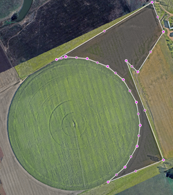
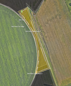
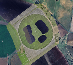
+ Drone-based aerial information capture may support paddock and livestock monitoring, livestock location and mustering support activities, infrastructure visibility, water and storage assessment, solar, pump, trough, and farming infrastructure monitoring, terrain and drainage awareness, repeatable seasonal monitoring, aerial distribution planning, and current property records supporting operational and management activities.
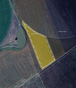
+ Drone operations may also support biosecurity and pest-management operational workflows, including repeatable biosecurity zone monitoring, spatially recorded monitoring areas, aerial operational support activities, and mapping workflows supporting fire ant and regional biosecurity management activities across agricultural, rural, and operational environments.
Operations
+ Farm and rural infrastructure inspections
+ Livestock, feedlot, and infrastructure visibility
+ Current property mapping and records
+ Livestock and feedlot monitoring
+ Livestock location and mustering support
+ Water point, dam, and tank assessment
+ Solar, pump, and trough inspections
+ Farm and rural infrastructure monitoring
+ Terrain and drainage visibility
+ Seasonal and repeat property monitoring
+ Licensed aerial distribution planning & support
+ Drone-based biosecurity & fire ant operations
+ Drone-based pest-management operations
+ Spatial recording & monitoring of biosecurity areas
Operational Value
+ Efficient large-area property visibility
+ Improved awareness across rural operations
+ Current and repeatable property records
+ Improved visibility of remote infrastructure
+ Livestock and feedlot operational support
+ Water and drainage visibility
+ Seasonal monitoring and comparison
+ Support for aerial distribution activities
+ Property planning and reporting support
+ Reduced property inspection time
+ Long-term property monitoring records
+ Structured drone-based operational workflows
+ Repeatable biosecurity zone monitoring and support
+ Accurate biosecurity zone mapping and monitoring
 |  |
|---|---|
 |  |
 |  |
 |  |
 |  |
 |  |
 |  |
 |  |
 |  |
 |  |
 |  |
 |  |
 |  |
 |  |
 |  |
 |  |
 |  |
 |  |
 |  |
 |  |
 |  |
 |  |
 |  |
 |  |
 |  |
